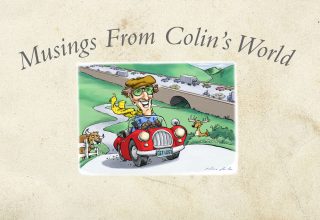
A few years ago I wrote an article called “The GPS is Messing with my Mind,” which talked about some of the problems of using GPS location systems. But if my observations sounded like complaints, nothing ever made me stop using it. It is just too powerful a tool to give up once you’ve experienced it. To be able to find your way from almost anywhere to almost anywhere — that’s immensely empowering.
How could you not be amazed by a device that can keep you from ever being lost again?
The GPS story is fascinating in itself, the way it works based on a principle called “trilateration,” calculating your location based on information from three different stationary satellites. Those are satellites launched into orbit at a speed matching the rotation of the Earth, so they seem stationary in relation to the land.
The first satellite navigation systems were developed by the U.S. military in 1960. The more accurate GPS system we have today was launched in 1980. In 1983, after an airline tragedy that might have been prevented by GPS, President Reagan released the technology to the public. But at that time the U.S. Navy scrambled the signal so civilians wouldn’t get the same degree of accuracy that the military had.
Then in 2000, President Clinton issued an order for the Navy to stop scrambling the signals so everyone could get the full accuracy of the system. That paved the way for the wave of consumer products that were based on GPS.
GPS technology is not perfect, not omnipotent. It has weaknesses. The GPS requires visibility of three satellites. That hampers it in some situations. It doesn’t work indoors, for example, or if the sky is cloudy, or if you are blocked from part of the sky by a mountain or skyscraper. The accuracy is to about four meters or 13 feet, which is usually enough. But now we have even better positioning technology.
Cellular Location Systems
Now we have location systems based on cellular phone technology. Rather than using satellites, they use cellular broadcasting towers. The cellular technology works with your phone. It doesn’t require clear skies. Its disadvantage is that it doesn’t have the global coverage of GPS, which uses 24 stationary satellites positioned to cover the entire world.
The cellular location technology can fill in spaces where the GPS does not reach. But it requires cell towers. So, if you are in a remote place without cell coverage, you won’t have it.
The great thing now is that you don’t have to choose between GPS and cellular location technology. Your phone can use them both. It coordinates the information and uses the advantages of each of them. Now whoever has a cell phone (with a charged battery) has a location system. In effect, you never have to get lost.
Another way to look at it is that you now have the freedom to get lost, to go off on glorious, exploratory jaunts, follow your nose, whatever interests you. And whenever you want to return to your hotel, or the airport, you can easily find your way. That is tremendously empowering.
If your phone is too much baggage for you, you can downsize. The location technology is incorporated into watches and other small pieces for hikers.
Brilliant as it was, my old GPS system seems clunky now. It evolved into a more sophisticated and powerful location technology. And I have grown increasingly attached to it.
Not only does it empower me to find almost any place with little effort, it also has some other advantages that go beyond the original value proposition of the product.
Cast Your Fate to the Winds
I discovered one of my favorite ways to use my mapping system by accident when my debit card was compromised by a nasty scammer, and I hadn’t gotten around yet to changing the auto-pay info on my EZ Pass account.
At that time I was traveling a certain route back and forth across southern New Hampshire repeatedly. Since I hadn’t yet sorted out my billing with EZ Pass, I set my phone mapping system to avoid toll roads. The surprising benefit was that although it tacked 20 minutes onto a two-and-a-half hour drive, it took me along scenic pathways and made the trip much more pleasurable.
At some point on the drive I realized that I was enjoying the trip more than usual. The part of the route that I had previously written off as dull was replaced by a new route through the backroads that was incomparably more scenic, and full of fascinating things to see.
I found myself traveling over a rolling landscape, with forests, mountains, farmhouses with barns and silos, pastures and horses and cows and a great many things I had never seen when I took that drive sticking mostly to Interstate Highways.
If you’re not in a hurry, you can set your map system to avoid toll roads and head off across the countryside, seeing the real character, the scenic quality of the place you’re driving through.
Beyond the Tunnel
I have nothing against the Interstate Highway system. I think it’s an amazing transportation system, and I use it most of the time for speed and convenience. But when speed is not the primary objective there is a lot of charm to be discovered by getting onto the side roads, the older highways.
It takes a lot of land to carve out a swath large enough to make room for four or six lanes, with a median strip in the middle and broad clearings on both sides. It’s almost like a section of city laid across the country, or an extended football field that extends for miles.
I’ve heard truck drivers refer to the Interstate highway system as “the tunnel.” You go into it in San Francisco and come out in New York. It’s all about efficient transportation, and thank God for it. It’s the artery system of commerce that fuels the country. But it’s not the only way to travel across America.
Unlike the winding backroads, the Interstate highways cut gigantic pathways across the landscape, creating a standardized sort of transportation system.
When you take the small two-lane highways it places you into the landscape. On small country highways, the branches of the trees sometimes spread into open space over the road and tend to form arches, cloistering you under a natural canopy.
The old highways follow the contour of the land. You are on a highway, but you’re still in the forests and on the hillsides. The old highways were roads that traveled through the forests and the countryside, rather than big, flat, nondescript tracks.
Passing can be difficult on a two-lane highway, but if I’m not in a hurry, I don’t mind getting behind a slow driver on a scenic highway. It gives me an excuse to take it easy and enjoy the view.
Today my mapping technology has become a real friend. I make the most of the advantages it brings. For me it’s empowering as the compass or the sextant were to the ancient explorers. My locating technology is my traveling companion, my faithful sidekick.
Your humble reporter,
A. Colin Treadwell
Great job Mr. Treadwell. As always, it’s a pleasure to read and looking forward to your next amazing article. Stay safe!
Enjoyed your comments about the GPS. Thought you might be interested in the book “Longitude” by Dave Sobel. It chronicles “the longitude problem”. Keep up the good work!!